Authorities seek solutions for sustainable sand management in Mekong Delta
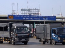
CANTHO – The Mekong Delta region loses an average 500 hectares of land due to landslides every year,
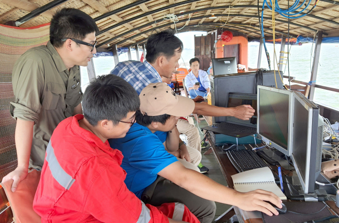
Mr. Hoang Viet, Freshwater Program Manager, Sustainable Sand Mining Project Director (behind, wearing glasses), working with the technical team. Photo: Ngoc Thang.
At the invitation of the World Wide Fund For Nature (WWF) Vietnam - Sustainable Sand Mining Project, I accompanied the delegation to "endoscope" the river to find sand. After more than half a month of drifting on a ship at many monitoring points downstream Mekong, the delegation had arrived at the Hau river section in Tra Noc area (Can Tho).
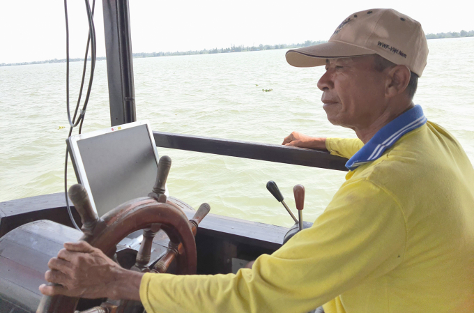
Ten people were divided into three groups to handle the work on this technical ship. Uncle Hai, a steersman from Vinh Long, who has a lot of experience in his job, said this after more than half a month onboard: “I was a bit confused at first, but now I'm used to it. The ship is full of equipment, so after performing the task, we must find a safe place to anchor.”
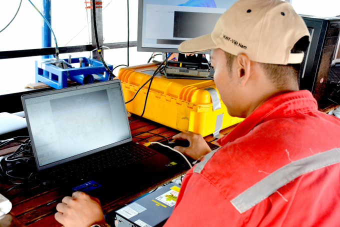
Mr. Hoang Viet, Freshwater Program Manager and Sustainable Sand Mining Project Director, said that the computer system was firmly installed on the ship to avoid shaking when facing big waves at work. A technical device mounted deep under the water was attached to the sides of the ship to transmit the "endoscope" signal into the computer system for processing.
Uncle Hai's task was to drive the ship according to the correct positioning and speed displayed on the computer screen placed in front of the steering wheel. The ship must go straight through each row like the checkered lines in a notebook. The "endoscopy" section of this Hau river interior was about 1.5 km. There were a total of approximately twenty survey lines along this part of the river following a scanning route from one riverbank to the other.
Ten people were divided into three groups to handle the work on this technical ship. Photo: Ngoc Thang.
It took approximately 6 hours to perform an "endoscopy" of this river interior. After taking some pictures, I was invited by Mr. Ha Huy Anh, Sustainable Sand Mining Project National Director, to sit in front of the computer screen to see photos and data. He then explained some technical knowledge about the path of sand grains.
“Surveying “the movement of sand dunes” lies within the activities to construct the bank of sand in the Mekong Delta. The research of the bank of sand is the study of the balance between the amount of sand flowing into the delta from the upper Mekong River with the amount of sand mined in the delta and the amount of sand discharged into the sea. This is one of three measurement activities on two tributaries of Tien and Hau rivers. There are also "hydrodynamic and sedimentary" surveys and "sand reserve" surveys to complete the sand bank for the Mekong Delta.”
* The “bank” of sand should be understood as the bank of a type of asset.
Whenever we see a large ship going in the opposite direction, Uncle Hai would howl a long horn so that everyone can notice. Photo: Ngoc Thang.
Mr. Ha Huy Anh hovered his mouse over a 3D computer image transmitted directly from the "endoscope" and explained, “This sand dune is approximately 40 m long. The area belongs to the section on Hau river, so there are still many sand dunes.”
I was not an expert, so when I looked at these sand dunes, I thought of the terraced fields on the plateau. The sand dunes in the riverbed were as beautiful as a picture that I have not known for a long time. I was in awe.
But when Mr. Ha Huy Anh continued to hover over another 3D computer image of the sand dunes downstream of My Thuan bridge on Tien river captured by the "endoscope" the past few days, I thought of lungs suffering from cancer from smoking too much. It looked horrible.
"We are exploiting sand in a ‘dredging until the end’ fashion deep under the sand dunes at the river bottom and taking away four times the amount of sand from upstream every year," said Mr. Ha Huy Anh.
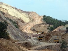
The situation worsened when the amount of sand from upstream to downstream became less and less due to the construction of many hydroelectric dams on the Mekong in recent years. Sand and sediment were stored in front of hydroelectric dams. Only a little sand and sediment could flow downstream when the upstream opened the floodgates. Grains of sand arriving at Tan Chau, An Giang (near the border of Cambodia) along the water flow would move to My Thuan (on the Tien river) and Can Tho (the Hau river).
Translated by Samuel Pham