

Green corn season on Dong Van rocky plateau
No longer the cold gray color of cat ears, under the June showers, Dong Van is covered with green thanks to
HA GIANG – Dong Van stone plateau each season has its own beauty: peach blossom blooms in spring, green corn in summer, blooming buckwheat in autumn, and frost in winter.
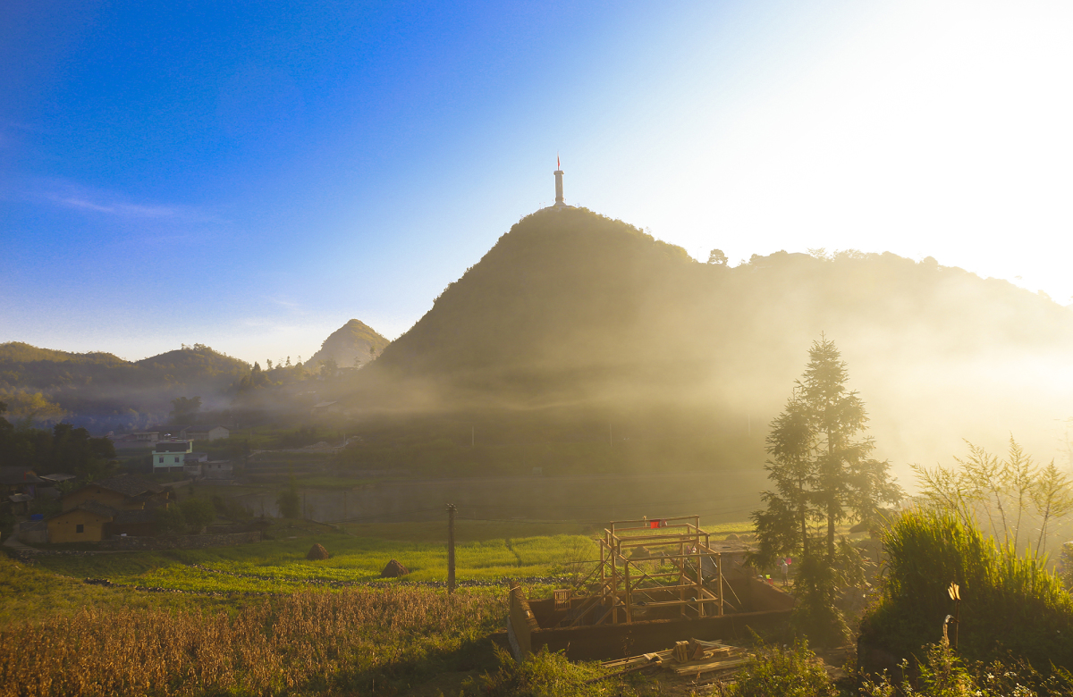
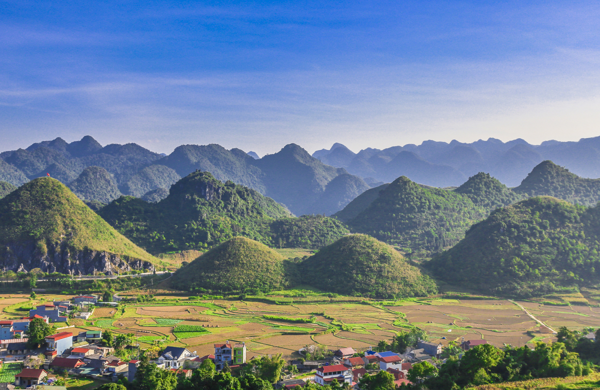
Dong Van rock plateau has an area of 2,356 km2 spread over four districts of Quan Ba, Yen Minh, Dong Van and Meo Vac. Located at an average altitude of about 1,400 – 1,600 m, the rocky plateau still retains traces from the tectonic activities of the earth’s crust tens of millions of years ago. Lung Cu flagpole (pictured) in Dong Van district is the northernmost boundary of Vietnam.
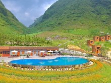
In 2010, Dong Van Karst Plateau was recognized by UNESCO as a Global Geopark. At that time, this was the first global geopark in Vietnam and the second in Southeast Asia. The rocky plateau is characterized by gray rock-covered mountains, steep terrain of cliffs, valleys, rivers and streams, and steep slopes. But also thanks to the geological tectonics, the rocky plateau has wild and majestic beauty, creating great tourism potential. According to statistics from the provincial Department of Tourism, about 65% of Ha Giang tourists come to the rocky plateau.
The gateway to Dong Van rock plateau is Quan Ba district. In the Quan Ba valley in Tam Son town, there is a mountain range that still attracts many passersby, which is the twin mountain Co Tien. Co Tien Mountain has a special shape, the two hills are not rough but round like an upside down bowl. In the region, there is a legend about the fairy who had to leave the world to go to heaven, leaving behind her nipples to raise her children to grow up to form these two hills.
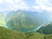
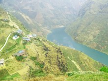
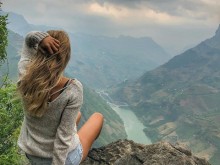
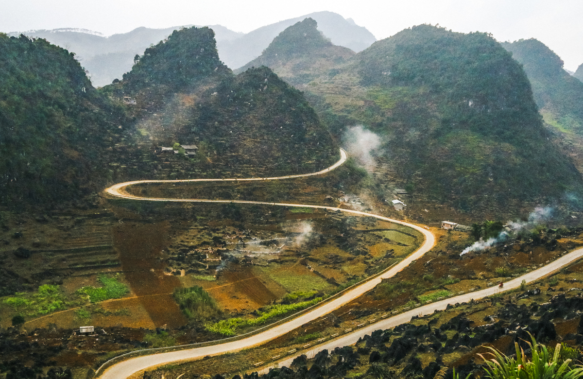
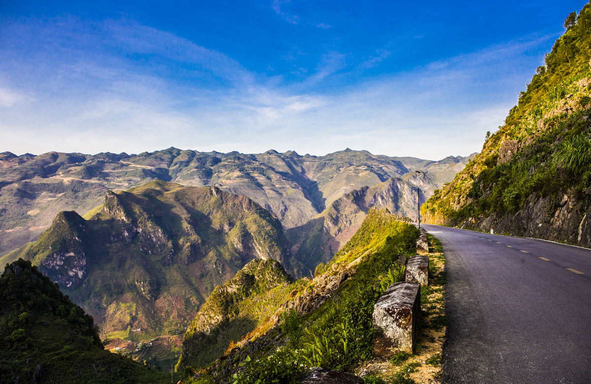
The rocky plateau terrain is relatively rugged, the roads here are winding and winding on the mountainside. Pictured is a section of Ma Pi Leng pass, one of the four great peaks of Vietnam’s pass, located at an altitude of 1,200 m above sea level. The scenery on the 20 km long pass is overwhelming with towering cliffs and deep abyss. From the top of the pass, looking down is the Nho Que river crossing.
Next to Ma Pi Leng pass, there is a craggy road on the cliff called white cliff nearly 4 km long at an altitude of 1,700 m. This road follows the cliffs with unique shapes and patterns. From the white cliffs, visitors can look down on Nho Que stream and admire the magnificent mountain scenery.
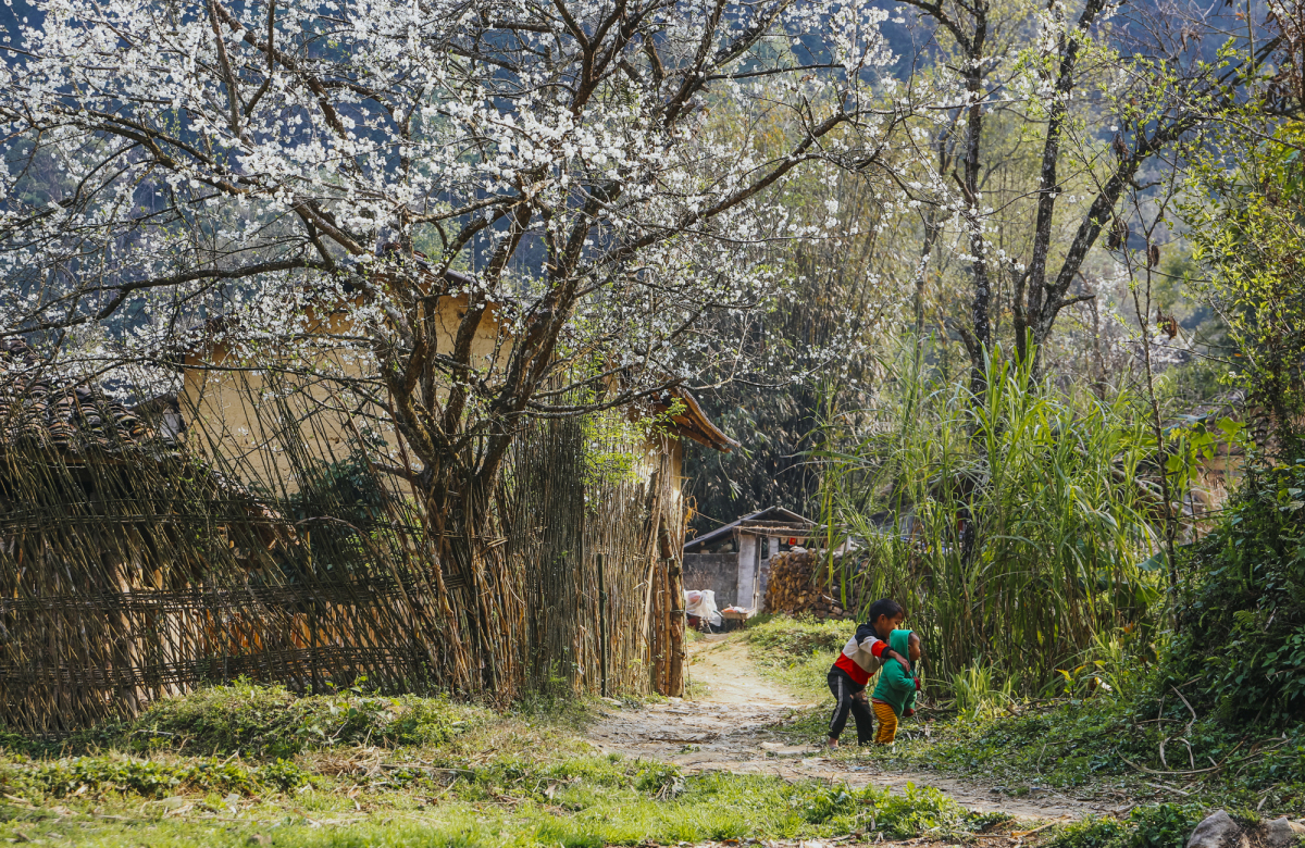
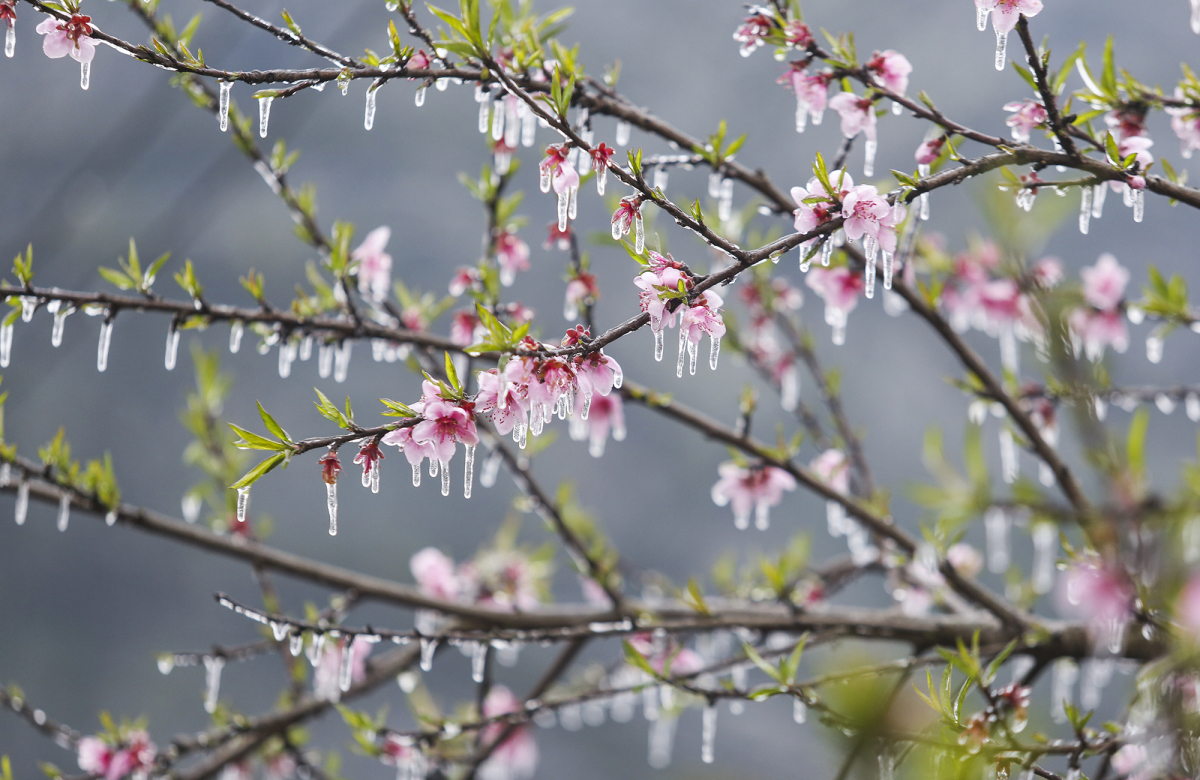
Each season, the rocky plateau has its own beauty. In spring, the whole plateau lights up when peach, plum, and pear blossoms bloom. The land becomes lyrical. Under the spring sun, the white and pink flowers stand out on the yellow houses. The houses are built according to the typical architecture of some ethnic minority communities in Ha Giang such as Mong, Dao, and Lo Lo. The walled houses are made entirely of earth to keep them cool in the summer, warm in the winter, and roofed with yin and yang tiles.
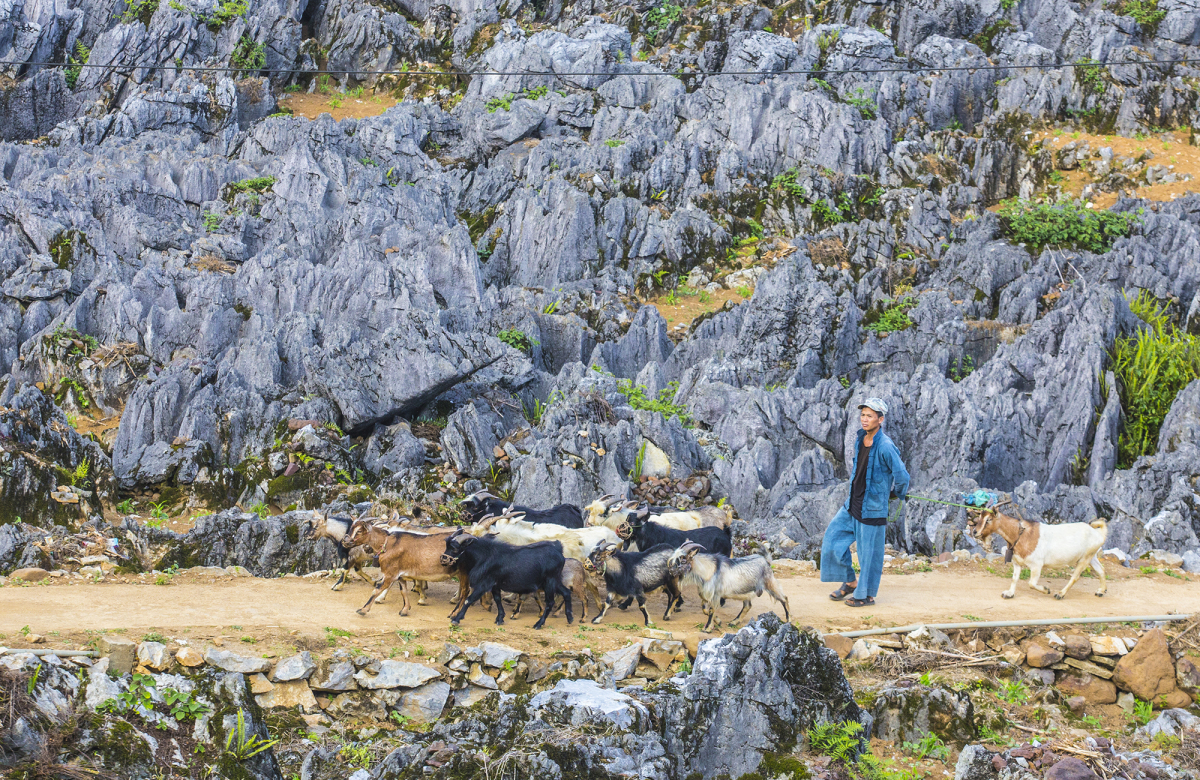
In the spring, when the weather warms up, people start farming. Due to the specific soil properties, it is difficult for plants to grow, so the people here have created a method of farming on the rock hole. In the new land-making season, men pull oxen to plow, women carry each bag of soil and pour it into a rock hole, sowing seeds, children follow adults to upland.
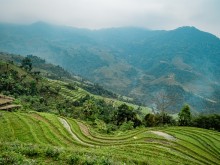
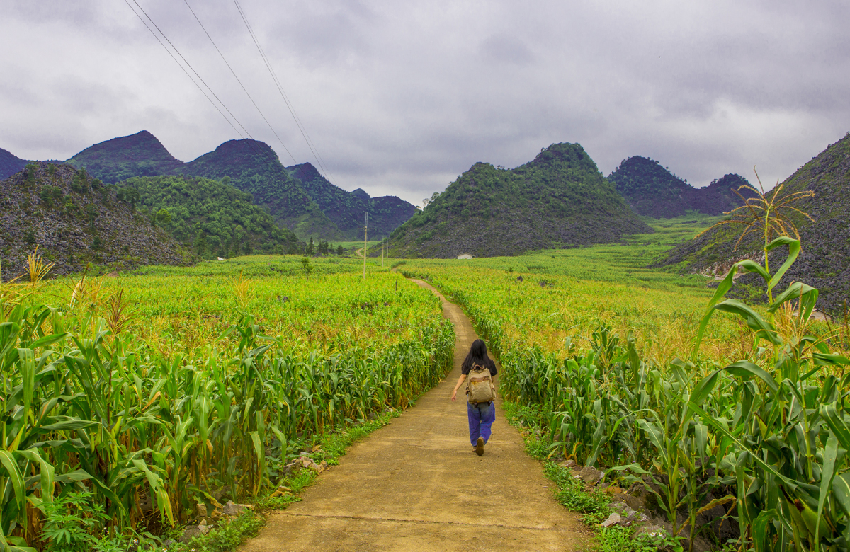
In the summer, corn begins to flourish. The familiar gray color of the rocky plateau is replaced by a green color. The whole plateau takes on a new life. Along with corn, the green color of Ha Giang summer is also woven by the flax fields, the rows of sandalwood stretching straight down the valley.
Around May and June is also the time when the Mong people in Ha Giang harvest flax as raw materials for weaving. At this time, the Hmong women pick flax, peel the flax, and pound it. Ladies and gentlemen always carry bundles of yarn with them to connect anywhere, when going to the fields, going to the market, and at home.
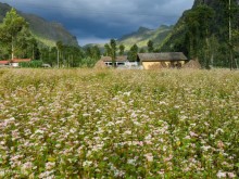
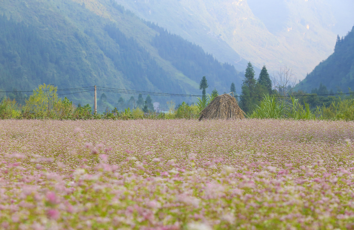
Ha Giang turns to autumn from around September, signaled by cold weather, strong winds and gradual downpours. In particular, from October to November is the time when the buckwheat triangle begins to bloom, forming a carpet of brilliant roses, immense like paintings. Pictured is a field of buckwheat flowers in Pho Cao, Dong Van.
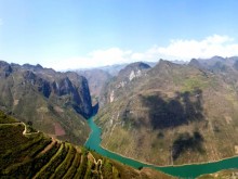
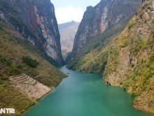
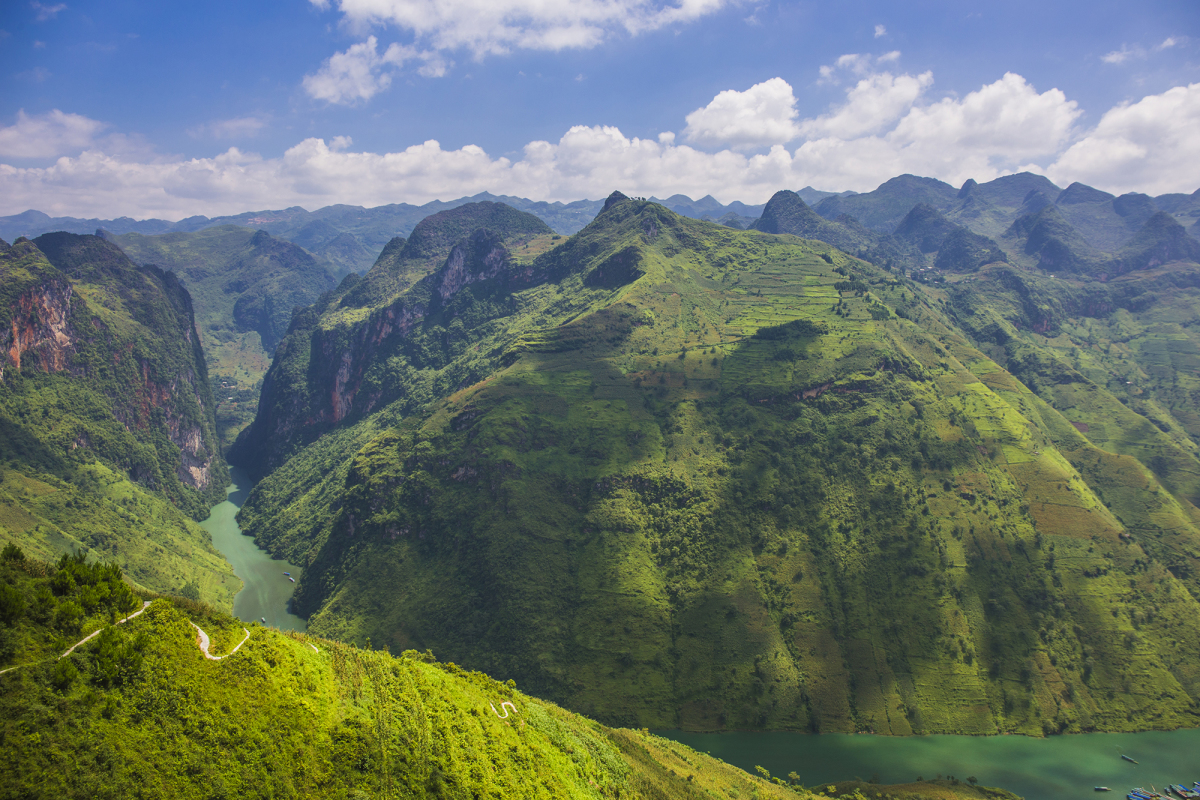
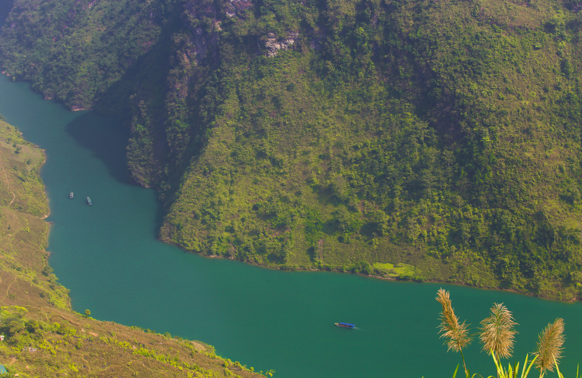
In autumn, when the sky is clear and the clouds clear, the water of Nho Que river is as green as jade. Looking down from Ma Pi Leng pass, Nho Que stream looks like a silk strip across the mountainside. Coming to Nho Que River, visitors can take a boat or kayak to enjoy the scenery of the two banks, across the 1.7 km long Tu San gorge with steep cliffs up to nearly 900 m high. This canyon is considered by researchers as one of the most spectacular landscapes of the Stone Plateau. This is also the deepest canyon in Vietnam.
In December, when winter comes, the rocky plateau is bitterly cold. Winter lasts until January and February. The higher you go to the high area, the lower the temperature, depending on the year, it can drop below 0 degrees Celsius, ice and snow appear.
In winter, the whole plateau is covered with frost, covered with a dark, quiet color. In the photo is a corner of Lao Xa, Sung La, and Dong Van villages when the temperature drops to -2 degrees Celsius.
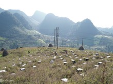
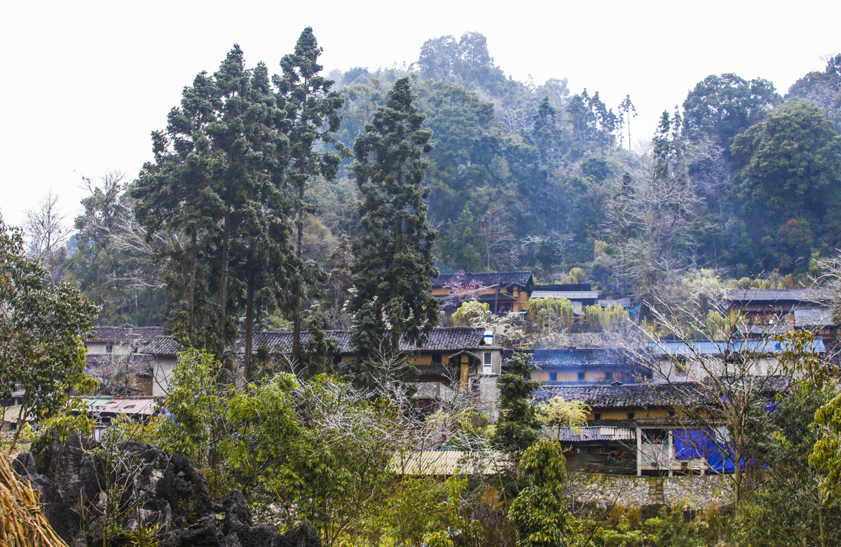
Dong Van rock plateau is also the living area of about 250,000 people from 17 ethnic minority communities. Here, many villages still keep wild features such as Lo Lo Chai, Nam Dam, Lao Xa, and Thien Huong. Ethnic communities living in the region still maintain their native culture through lifestyle, architecture, cuisine, and rituals. In addition, in many localities in the rocky plateau, markets are still maintained. This is considered as a living museum about the culture – life of the Ha Giang people.
Photo: Internet (Vinlove.net)